|
Lake Tahoe / Truckee Hike of the Month Hiking the Flume Trail |
|
Peaceful and serene views of Lake Tahoe from the Flume Trail! |
|
A Real Estate Newsletter for my Clients and Friends |

|
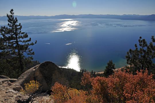
At 1600 feet above the eastern shore of Lake Tahoe, the Flume Trail has spectacular views in a peaceful setting. Along the hike we met a bicyclist who flew in from Ohio. He had just fulfilled one of the dreams for his dream list: to hike or bike the Flume Trail above Lake Tahoe!
The story of the Flume Trail starts in the mid 1800s. The gold and silver mining at Virginia City and Gold Hill required timber and water. This spurred the creation of Marlette Lake, Hobart Reservoir, Spooner Lake and an intricate system of flumes and pipelines (The Marlette-Hobart Water System). Today this is a National Civil Engineering Landmark. The box flume that carried water (not timber) from Marlette Lake to Tunnel Creek Station is now the site of the popular Marlette Flume Trail.
This flume and another from the north combined and entered a 4000' tunnel which emptied on the east side of the Carson Range. It then joined the key pipeline of the Comstock, the Inverted Siphon. This high pressure pipeline brought water to a reservoir near Virginia City. It could deliver up to 10 million gallons/day. This pipeline still works, although the water supplied now primarily comes from Hobart Reservoir and the Red House diversions. Red House is the last remaining flume maintenance station and was rebuilt about 1910 after a devastating flood.
To access the Flume Trail, we parked along the shoulder of Route 28 at the old Ponderosa Ranch near Incline Village. You can start the hike by taking the paved access road that winds up from Route 28 to above the old Ponderosa Ranch. At the locked gate the paved road changes to a sandy loam dirt road that goes up about 2.6 miles to the Flume Trail. We then hiked along the Flume Trail 4.5 miles to Marlette Lake, enjoyed lunch at the lake, and then hiked back.
You can also bike or hike from Spooner Summit to where the trail descends to the old Ponderosa Ranch. At this point you can take the dirt road down to the highway and catch a pay shuttle (reserve this in advance), or bike or hike back to Spooner Summit.
To make this a one way hike simply leave a car at the shoulder for Route 28 next to the Ponderosa Ranch. Then drive to Spooner Summit and hike back along the Flume Trail to your car at the Ponderosa Ranch.
Enjoy the photos that follow. |
|
All content Copyrighted © John Williamson 2011. All rights reserved. Contact John Williamson and obtain written permission before using or reproducing any material contained on this site. |
|
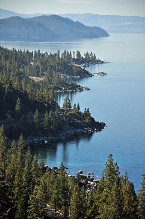
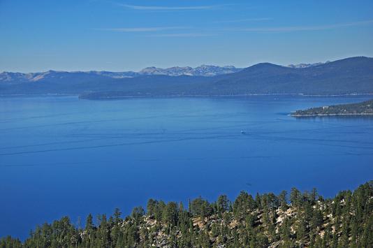
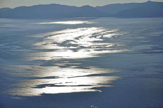
Morning light reveals a tranquil eastern shore of Lake Tahoe. |
|
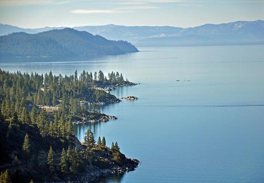
Another morning view with hardly a ripple on the lake. |
|
Picturesque view across the lake. |
|
View of northwestern end of Lake Tahoe |
|
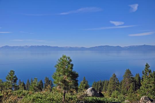
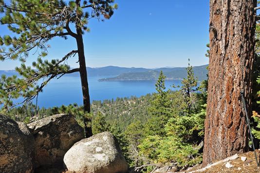
A tree, a boulder, a view of the lake. |
|
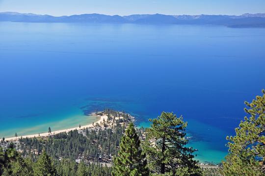
Birds eye view of Sand Harbor. |
|
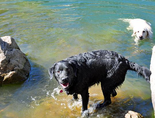
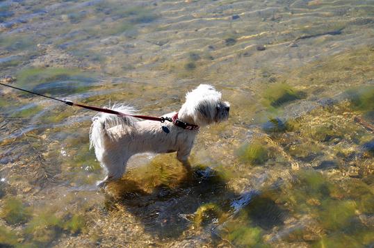
Come on in, the water’s fine! Sabree and Aspen enjoying Marlette Lake. |
|
To swim or not to swim? That is the question. To swim with the big dogs, or only just get my feet wet? |
|
A mountain lake, a stick to fetch, another memory. |

|
A good day ends with sunlight dancing on the water. |
|
John Williamson 530-412-1356
|
|
Resort and Second Home Property Specialist |

|
11500 Donner Pass Road Truckee, CA 96161 |
|
Accredited Buyer Representative |